The area is made up of Paleozoic materials: slate, limestone and granite. These
materials are the basement of the Alpine Cycle Sediments in the Pyrenees. Today,
this basement comes to the surface in the Axial Zone, tectonically piled up
southwards through Alpine age thrusts.
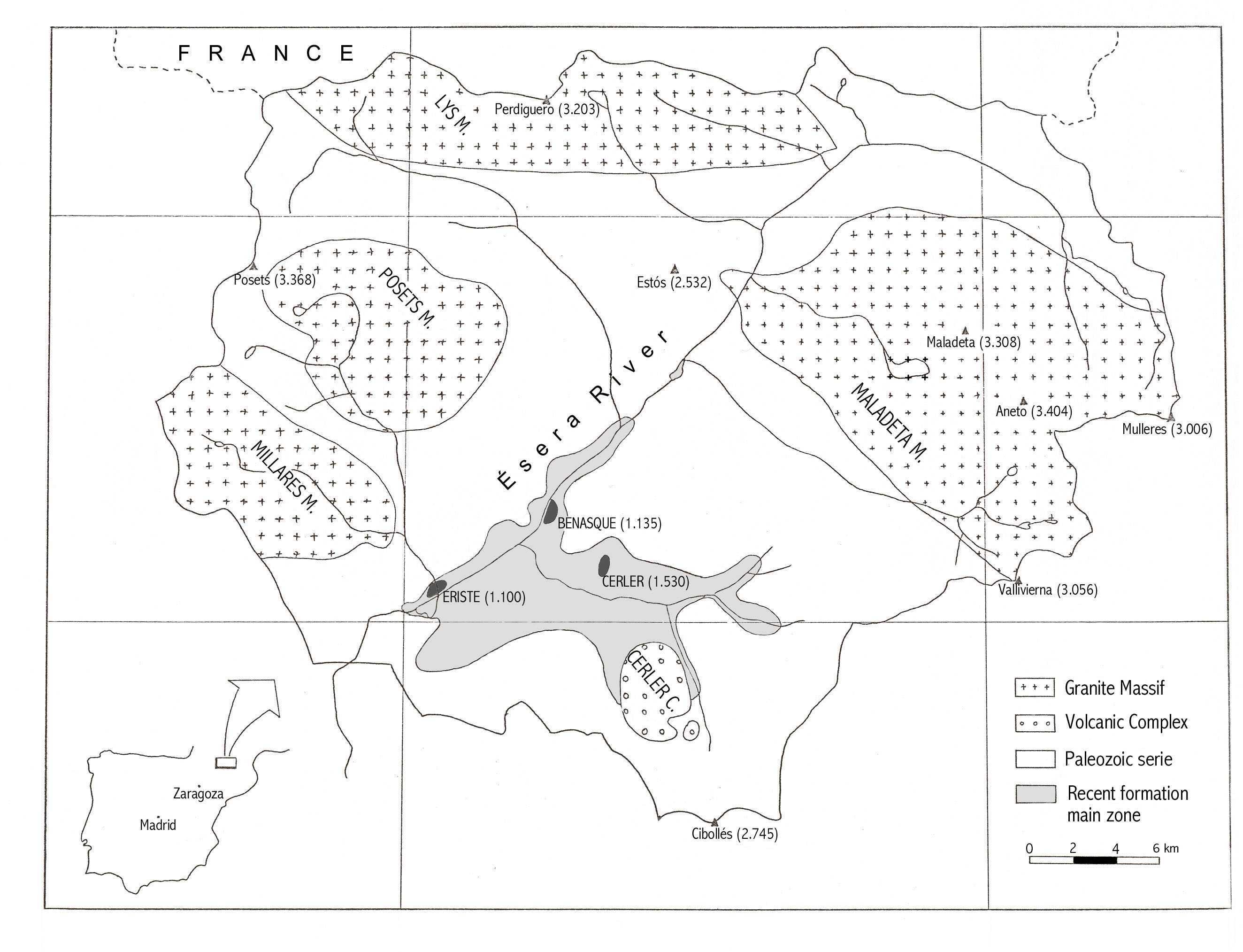
In this Axial Zone, there are the highest Pyrenean peaks (Maladeta
3.308 m, Aneto 3.404 m, Russel 3.205 m, Salenca 3.010 m) exactly, within the
Maladeta Granite Massif. There are four Igneous bodies: Posets-Millares Granite
Massif (very similar to the Maladeta one), Lys Granite Massif and Cerler
Volcanic Complex. All of them intruded during the Carboniferous cutting the
upper Paleozoic materials.
The relief is controlled mainly by two
factors: lithology and processes (fundamentally glacial). In the northern part,
where the granite lithologies are common, the glacial and periglacial morphology
has more entity. The south half is made up of less strong and firm materials,
thus the generated relief is not so rugged as before. The standing out
morphology consists of fluvial incision, circular breaks and mass movement.